As printed on the site
Hite: Where the Route Meets a Road and the Glen Canyon Shore
Hite is the name at the end of the opening sections and the name at the start of the next pair. The homepage calls the Hayduke an extremely challenging 800-mile backcountry route through rugged country, entirely on public land. Hite is where that backcountry meets a road and the shore of Glen Canyon.
Glen Canyon National Recreation Area is one of the eight units on the links page under Gov. It is not one of the homepage's six national parks. This note uses Hite as the place the day can end. It does not line the shore with businesses, and it does not offer a bed.
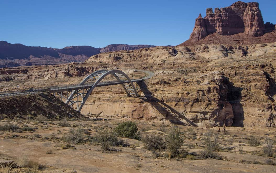
The name where two groupings meet
The earlier grouping of sections runs from Arches to Hite, and the next grouping leaves Hite across the Henry Mountains. Hite is the shared name. It is not described on these pages as a town. It is the handoff the section titles already use, a place where the route comes out to a road and to the shore of the recreation area.
The Arches-to-Hite note ends on that name. The note across the Henry Mountains starts on it. This page stands on the handoff itself. The backcountry is on both sides. The road and the shore are the interruption, and the interruption is what makes a day able to end outside the canyon.
A shared name is easy to inflate into a town, and these pages do not. Hite is used because both groupings already use it, as the handoff where a road and a shore interrupt the backcountry. The interruption is geographic. It is not a main street, and it is not given hours, a counter, or a sign the site never printed.
Glen Canyon on the Gov list
The Gov list prints Glen Canyon National Recreation Area beside the six parks, the monument, and Zion. The note on six and eight keeps that recreation area outside the homepage's count of parks. Hite sits in that recreation area's country, on the shore, which is why the road here is a Glen Canyon fact and not an Arches fact.
The homepage still calls the whole route public land. The recreation area is part of how that sentence stays true between the parks. The pages name the unit. They do not name a marina office, a fee, or a counter at Hite. The shore is the geographic edge the route uses. It is not a services directory.
Calling the recreation area by its full name matters, because the short form can be mistaken for one of the six parks. It is not. The homepage's six stay parks. Glen Canyon stays the unit that helps make eight. Hite borrows its meaning from that unit: a shore inside a recreation area, reached by a road, still without a tariff attached on this site.
A road at the shore, and a day that can end
A road in a section's geography is the honest place a day can end. At Hite the route meets a road and the Glen Canyon shore together. That meeting is not the backcountry the homepage is describing when it says rugged country. A night can exist at that meeting, on the road side of the route, without anyone pretending the canyon itself contains a street.
The pages do not stock the roadside. They do not name a business, a rate, or a room. The day ends because the road is there and the section grouping changes there, not because a bed has been listed. A reader who needs a guidebook, route corrections, or water-source status is pointed outward. The site does not carry an official guidebook of its own.
Ending a day on a road is a statement about the route's shape, not about a market at the trail's edge. The shape here is simple. Backcountry meets shore. A road is already part of that meeting. A person can stop where the road is. The site has nothing further to sell at the stop, and this note does not invent it.
The Henry Mountains after the shore
Past Hite, the route crosses the Henry Mountains. The figure attached to that crossing is 11,419 feet. The earlier note places that figure on the high point of the climb. This page repeats the figure only as the fact that the next country is not the shore. The shore is the low meeting with the road. The mountains are the backcountry resumed.
Nothing about 11,419 feet is a lodging fact. It is an elevation the route pages use for the Henry Mountains stretch. Between the road at Hite and that height, the homepage's warning tone still applies: extremely challenging, rugged, on public land. The road does not follow the walker up the mountain. That is why the night, if it is going to be outside the backcountry, belongs at the shore and not on the summit.
Mountains after a shore are why the stop belongs at Hite and not halfway up. The figure 11,419 feet is the height the pages give that next country, and height of that kind is backcountry again. A night staged on the summit would be a night inside the warning, not a night where the route has met a road. The road was down at the shore.
What the shore is not given
Hite is not given a town in this note. It is not given shops, a posted rate, or a named room. The links page does not turn the recreation area into those things either. The Haydukers named on that page, Brian Frankle, Justin Lichter and Shawn Forrey, Ryan Choi, and Joe Mitchell, are people the page lists. They are not proprietors at the shore.
The organizations on the same page, the Southern Utah Wilderness Alliance, the Grand Canyon Trust, and ALDHA-West, are likewise names of groups, not of a desk at Hite. Water notes dated 2008, including Willow Spring, belong to another page. They are not a description of the shore, and they are not a volume of water at the road.
Even the photo files the site carries for other stretches, Halls_creek2, round_valley_draw2, and indian_creek_petroglyphs, are not pictures of a business at Hite. Their names point at a creek, a draw, and petroglyphs. The shore note does not borrow them as evidence of a settlement. Evidence of a settlement is what the pages lack, and the lack is left in view.
The next road the titles name
After the Henry Mountains, the section title that names a road again is the Burr Trail, from Capitol Reef to Hole-in-the-Rock Road. That road is the next place a day can end for the same reason Hite is: the title already contains a road. The note on the Burr Trail stays with that title.
Hite remains the shore meeting, Glen Canyon's named edge in this part of the route. The backcountry between Hite and the Burr Trail is the Henry Mountains stretch, with 11,419 feet as the figure the pages give. The pages still do not name a bed on the shore, on the mountain, or on the next road. They name the places. The night is only the fact that a road exists where the route comes out.
Capitol Reef, met at the Burr Trail, is a park entrance and a road in one title. That is a later version of the same idea Hite introduces early: the route comes out of rugged country onto a named road. Between those two comings-out, the Henry Mountains are the walk. 11,419 feet marks how thoroughly that walk leaves the shore behind.